Home > Arts > Artists > Grant Wood
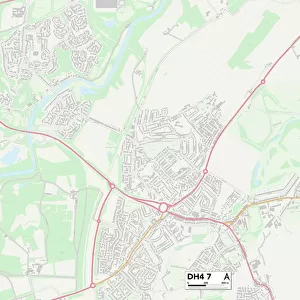
County Durham DH7 7 Map

![]()
Wall Art and Photo Gifts from Map Marketing
County Durham DH7 7 Map
Postcode Sector Map of County Durham DH7 7
Media ID 19968376
Ash Avenue Beech Grove Blackburn Close Boundary Close Broom Crescent Broom Lane Castle View Chadwick Close Chestnut Grove College View Cook Avenue County Durham Elder Close Elm Grove Grant Close Hall Avenue Hilltop Road Hogarth Close Hunter Avenue Kingston Avenue Lindsay Road Mill Lane Oakridge Road Rowley Close Station Road Taylor Avenue Thornley Close Valley View Whitehouse Lane Woodland Close Woodside Avenue Fir Park
FEATURES IN THESE COLLECTIONS
> Arts
> Artists
> Grant Wood
> Europe
> United Kingdom
> England
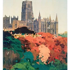
> County Durham
> Durham
> Europe
> United Kingdom
> England
> Durham
> Bearpark
> Europe
> United Kingdom
> England
> Durham
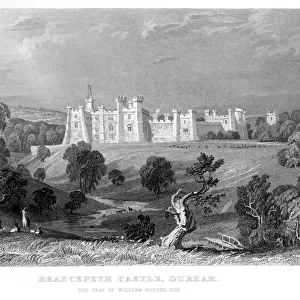
> Brancepeth
> Europe
> United Kingdom
> England
> Durham
> Durham
> Europe
> United Kingdom
> England
> Durham
> Thornley
> Europe
> United Kingdom
> England
> Durham
> Woodland
> Europe
> United Kingdom
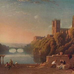
> Heritage Sites
> Durham Castle and Cathedral
> Europe
> United Kingdom
> Scotland
> Aberdeenshire
> Blackburn
> Europe
> United Kingdom
> Scotland
> West Lothian
> Blackburn
> Map Marketing
> Postcode Sector Maps
> DH - Durham
> Map Marketing
> UK Maps
MADE IN THE USA
Safe Shipping with 30 Day Money Back Guarantee
FREE PERSONALISATION*
We are proud to offer a range of customisation features including Personalised Captions, Color Filters and Picture Zoom Tools
SECURE PAYMENTS
We happily accept a wide range of payment options so you can pay for the things you need in the way that is most convenient for you
* Options may vary by product and licensing agreement. Zoomed Pictures can be adjusted in the Cart.