Home > Maps and Charts > Related Images
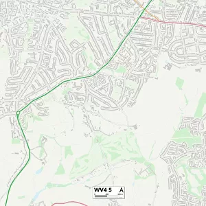
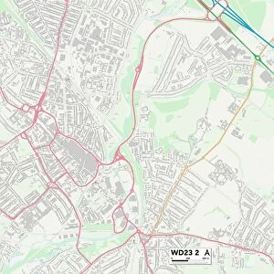
Wolverhampton WV3 8 Map

![]()
Wall Art and Photo Gifts from Map Marketing
Wolverhampton WV3 8 Map
Postcode Sector Map of Wolverhampton WV3 8
Media ID 19983322
Adams Road Chestnut Way Coppice Road Cranford Road Farm Road Fir Tree Road Glendale Close Headland Road Highlands Road Lamorna Close Meadow Road Orchard Court Orchard Crescent Pinewood Close Piper Road School Close The Avenue Uplands Avenue Uplands Drive Westfield Grove Whitehouse Avenue Willow Road Windmill Lane Windsor Gardens Wolverhampton Woodland Crescent Woodland Road Wootton Road York Road
FEATURES IN THESE COLLECTIONS
> Europe
> United Kingdom
> Scotland
> Highlands
> Related Images
> Map Marketing
> Postcode Sector Maps
> WV - Wolverhampton
> Maps and Charts
> Related Images
MADE IN THE USA
Safe Shipping with 30 Day Money Back Guarantee
FREE PERSONALISATION*
We are proud to offer a range of customisation features including Personalised Captions, Color Filters and Picture Zoom Tools
SECURE PAYMENTS
We happily accept a wide range of payment options so you can pay for the things you need in the way that is most convenient for you
* Options may vary by product and licensing agreement. Zoomed Pictures can be adjusted in the Cart.