Home > Europe > France > Paris > Maps
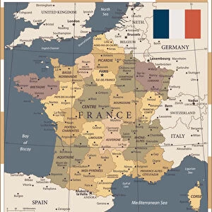
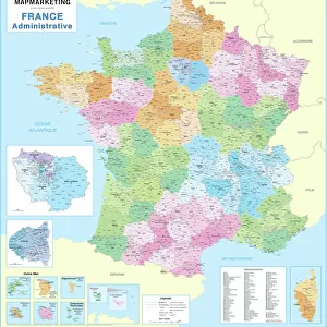
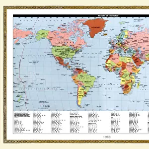
France Administrative Political Map

![]()
Wall Art and Photo Gifts from Map Marketing
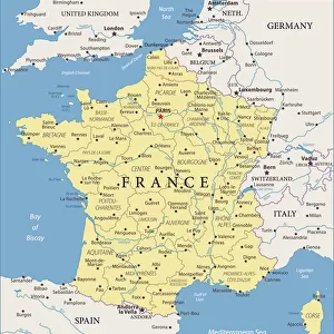
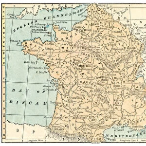
France Administrative Political Map
A detailed Administrative map of France showing the political administrative divisions of the country. Each Departement is coloured individually and numbered with the appropriate Numero de Departement and then grouped into the larger Regions. Within each Departement the constituent Cantons are also marked. Major cities and towns are shown and there are inserts showing Paris and its environs as well as Corsica and Franceaes dependent overseas territories
Media ID 19949231
© Map Marketing Ltd
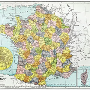
Administrative Canton Counties
FEATURES IN THESE COLLECTIONS
> Arts
> Photorealistic artworks
> Detailed art pieces
> Masterful detailing in art
> Europe
> France
> Canton
> Related Images
> Europe
> France
> Paris
> Maps
> Europe
> France
> Paris
> Politics
> Maps and Charts
> Popular Maps
> Maps and Charts
> Related Images
MADE IN THE USA
Safe Shipping with 30 Day Money Back Guarantee
FREE PERSONALISATION*
We are proud to offer a range of customisation features including Personalised Captions, Color Filters and Picture Zoom Tools
SECURE PAYMENTS
We happily accept a wide range of payment options so you can pay for the things you need in the way that is most convenient for you
* Options may vary by product and licensing agreement. Zoomed Pictures can be adjusted in the Cart.