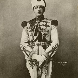
Home > Asia > Turkey > Related Images
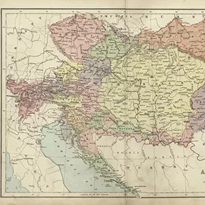
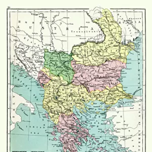
Austria-Hungary and Neighbouring Lands - Map, 1920. Creator: John Bartholomew & Son

![]()
Wall Art and Photo Gifts from Heritage Images
Austria-Hungary and Neighbouring Lands - Map, 1920. Creator: John Bartholomew & Son
Austria-Hungary and Neighbouring Lands, c1914, (c1920). Map of the Austro-Hungarian Empire and surrounding countries at start of the First World War. From " The Great World War - A History" Volume II, edited by Frank A Mumby. [The Gresham Publishing Company Ltd, London, c1920]
Heritage Images features heritage image collections
Media ID 19175143
© The Print Collector/Heritage Images
Adriatic Albania Austria Hungary Austro Hungarian Austro Hungarian Empire Balkans Bartholomew Bartholomew And Co Bartholomew Co Bartholomew John Son Bulgaria Frank Arthur Frank Arthur Mumby Gresham Publishing Co Ltd Gresham Publishing Company Jg Bartholomew John And Son John Bartholomew And Co John Bartholomew And Son John Bartholomew And Son Ltd John Bartholomew Co John Bartholomew Son John Bartholomew Son Ltd John Son Keystone Archives Montenegro Mumby Mumby Frank Arthur Romania Serbia Switzerland The Great World War A History Theatre Of War Turkey Turkish
FEATURES IN THESE COLLECTIONS
> Asia
> Turkey
> Related Images
> Europe
> Albania
> Related Images
> Europe
> Austria
> Related Images
> Europe
> Bulgaria
> Related Images
EDITORS COMMENTS
This print showcases a map of Austria-Hungary and its neighboring lands during the tumultuous period of the First World War. Created by John Bartholomew & Son, this historical artifact offers a glimpse into the political landscape of Europe in the early 20th century. The intricate details and vibrant colors bring to life the vast Austro-Hungarian Empire, stretching across Central Europe with its diverse array of territories. From Germany to Romania, from Italy to Russia, this map highlights the empire's extensive reach and influence over various countries. As we delve deeper into this visual masterpiece, we can observe how geographical features such as seas and mountains shaped borders and influenced alliances. The Adriatic Sea serves as a prominent backdrop while surrounding nations like Serbia, Montenegro, Albania, Bulgaria, Switzerland, and Turkey add further context to the region's complex dynamics. This map not only provides an invaluable resource for historians but also sparks curiosity about the events that unfolded during this pivotal time in history. It serves as a reminder of how borders have shifted over time due to conflicts and changing political landscapes. Preserved within these lines lies a story waiting to be explored - one that encompasses power struggles between empires, cultural diversity within regions under Austrian-Hungarian rule, and ultimately sets the stage for significant geopolitical changes that would shape our world today.
MADE IN THE USA
Safe Shipping with 30 Day Money Back Guarantee
FREE PERSONALISATION*
We are proud to offer a range of customisation features including Personalised Captions, Color Filters and Picture Zoom Tools
SECURE PAYMENTS
We happily accept a wide range of payment options so you can pay for the things you need in the way that is most convenient for you
* Options may vary by product and licensing agreement. Zoomed Pictures can be adjusted in the Cart.