Home > Fine Art Storehouse > Map
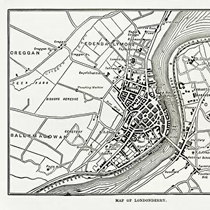
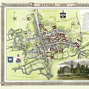
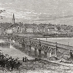
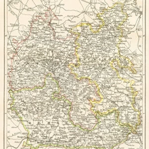
Map of Londonderry, Derry, Donegal, Northern Ireland, Victorian Engraving, 1840

![]()
Wall Art and Photo Gifts from Fine Art Storehouse
Map of Londonderry, Derry, Donegal, Northern Ireland, Victorian Engraving, 1840
Very Rare, Beautifully Illustrated Antique Engraving of Map of Londonderry, Derry, Donegal, Northern Ireland, Victorian Engraving, 1840. Source: Original edition from my own archives. Copyright has expired on this artwork. Digitally restored
Unleash your creativity and transform your space into a visual masterpiece!
bauhaus1000
Media ID 14549505
© This content is subject to copyright
FEATURES IN THESE COLLECTIONS
> Fine Art Storehouse
> Map
> Historical Maps
> Fine Art Storehouse
> Travel Imagery
> Travel Destinations
> Ireland
> Londonderry, Northern Ireland
MADE IN THE USA
Safe Shipping with 30 Day Money Back Guarantee
FREE PERSONALISATION*
We are proud to offer a range of customisation features including Personalised Captions, Color Filters and Picture Zoom Tools
FREE COLORIZATION SERVICE
You can choose advanced AI Colorization for this picture at no extra charge!
SECURE PAYMENTS
We happily accept a wide range of payment options so you can pay for the things you need in the way that is most convenient for you
* Options may vary by product and licensing agreement. Zoomed Pictures can be adjusted in the Cart.