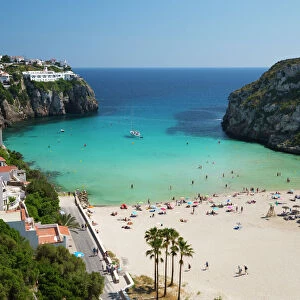
Castile and Leon, Spain, satellite image C014 / 0076

![]()
Wall Art and Photo Gifts from Science Photo Library
Castile and Leon, Spain, satellite image C014 / 0076
Castile and Leon, satellite image. North is at top. Natural colour satellite image showing the Castile and Leon autonomous community, Spain, with the surrounding Spanish autonomous communities shaded out. Spain is situated in southwestern Europe on the Iberian Peninsula. It is divided into 17 autonomous communities, and 2 autonomous cities. It is bordered by Portugal (left), Andorra (small, upper right), France (upper right), the Mediterranean Sea (blue, right), and the Atlantic Ocean (blue, left). Spain is separated from Morocco (bottom centre), on mainland Africa, by the Strait of Gibraltar. Algeria (bottom right) and the Balearic Islands (centre right) of Mallorca, Menorca and Ibiza can also be seen. Image compiled from data acquired by the LANDSAT 5. Images highlighting all other regions of this country are available. For further information please contact SPL. Images highlighting all other regions of this country are available. For further information please contact SPL
Science Photo Library features Science and Medical images including photos and illustrations
Media ID 9218827
© PLANETOBSERVER/SCIENCE PHOTO LIBRARY
2000 Africa Algeria Atlantic Ocean Birds Eye View Border Borders Boundaries Boundary Cartography Coast Coastal Coastline Communities Countries Country Earth Observation Environmental France From Above From Space Frontier Frontiers Gibraltar Iberian Peninsula Island Land Landsat 5 Landsat 7 Mallorca Masked Mediterranean Sea Morocco Nation Natural Colour Portugal Satellite Satellite Image Shore Shoreline Spain State Topographic Topography Western Europe Andorra Balearic Islands Bay Of Biscay Castile And Leon Ibiza Menorca Strait Of Gibraltar
EDITORS COMMENTS
This stunning satellite image captures the breathtaking beauty of Castile and Leon, an autonomous community in Spain. The photograph showcases the region's diverse landscapes and highlights its strategic location on the Iberian Peninsula in southwestern Europe. With North at the top, this natural color image displays Castile and Leon surrounded by other Spanish autonomous communities that are shaded out. The country itself is bordered by Portugal to the left, Andorra (small, upper right), France (upper right), the Mediterranean Sea (blue, right), and the Atlantic Ocean (blue, left). Notably, Spain is separated from Morocco on mainland Africa by the iconic Strait of Gibraltar. In addition to these geographical features, Algeria can be seen towards the bottom right of this photo. Furthermore, one can spot Mallorca, Menorca, and Ibiza - collectively known as Balearic Islands - located towards center-right. The compilation of data acquired by LANDSAT 5 has resulted in this remarkable image that offers a glimpse into Castile and Leon's rich cultural heritage and natural wonders. For those interested in exploring more regions within Spain through similar images or seeking further information about this particular print captured by PLANETOBSERVER/SCIENCE PHOTO LIBRARY (not affiliated with any company mentioned here), please contact SPL for an immersive visual experience.
MADE IN THE USA
Safe Shipping with 30 Day Money Back Guarantee
FREE PERSONALISATION*
We are proud to offer a range of customisation features including Personalised Captions, Color Filters and Picture Zoom Tools
SECURE PAYMENTS
We happily accept a wide range of payment options so you can pay for the things you need in the way that is most convenient for you
* Options may vary by product and licensing agreement. Zoomed Pictures can be adjusted in the Cart.