Home > Mary Evans Prints Online > National Archives
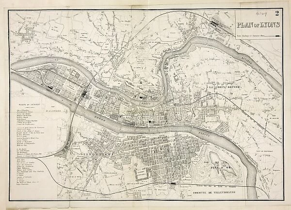
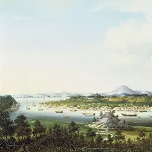
Map of Lyon
![]()

Wall Art and Photo Gifts from Mary Evans Picture Library
Map of Lyon
Map of the city of Lyons and the River Rhone Date: 19th century
Mary Evans Picture Library makes available wonderful images created for people to enjoy over the centuries
Media ID 7403399
© Mary Evans Picture Library 2015 - https://copyrighthub.org/s0/hub1/creation/maryevans/MaryEvansPictureID/10474585
EDITORS COMMENTS
1. Title: "A Glance into the Past: Exploring the 19th Century Map of Lyon and the Rhone River" This antique map print, hailing from the 19th century, offers a fascinating glimpse into the urban landscape and geography of Lyon, a historic city located in eastern France, and the majestic Rhone River that flows through it. The map, with its intricate details and meticulous illustrations, invites us to embark on a journey through time and discover the city's rich history. The map meticulously depicts the urban layout of Lyon during the 19th century, including its various districts, streets, and landmarks. The Rhone River, a significant natural feature that has shaped the city's development, is prominently featured, as it winds its way through the heart of Lyon, connecting the Saone and Rhine rivers. The map also reveals the presence of various important structures and institutions that were integral to the city's cultural, economic, and social fabric during that era. These include the Fourvière Hill, a popular tourist destination and site of historical significance, the Basilique Notre-Dame de Fourvière, a Roman Catholic basilica, and the Halle de la Martinière, a historic market hall. Moreover, the map provides valuable insights into the city's transportation infrastructure during the 19th century, with the presence of various tram and railway lines, as well as the Rhone River's role as a major transportation artery. This 19th century map of Lyon and the Rhone River serves as an essential resource for historians, urban planners, and anyone with an interest in the history and development of this remarkable city. It offers a unique perspective into the past, allowing us to appreciate the city's rich heritage and the transformations it has undergone over the centuries.
MADE IN THE USA
Safe Shipping with 30 Day Money Back Guarantee
FREE PERSONALISATION*
We are proud to offer a range of customisation features including Personalised Captions, Color Filters and Picture Zoom Tools
SECURE PAYMENTS
We happily accept a wide range of payment options so you can pay for the things you need in the way that is most convenient for you
* Options may vary by product and licensing agreement. Zoomed Pictures can be adjusted in the Cart.

