Home > Europe > United Kingdom > England > Cheshire > Langley
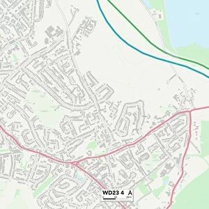
Watford WD25 7 Map

![]()
Wall Art and Photo Gifts from Map Marketing
Watford WD25 7 Map
Postcode Sector Map of Watford WD25 7
Media ID 19983230
Ashfields Blackthorn Close Boundary Way Bramley Court Campion Close Chapel Close Comet Close Farmers Close Forest Road Grasmere Close Halifax Close High Road Horseshoe Lane Hunters Lane Ivy Close Jordan Close Kingswood Langley Lane Linden Lea Merlin Way Milner Close Nottingham Close Old Forge Close Orchard Avenue Poplars Close Russell Crescent Springfield Road St Michaels Drive The Brow Valley Rise Watford Westland Close Whittle Close Woodgate Woodside
FEATURES IN THESE COLLECTIONS
> Arts
> Landscape paintings
> Forest and woodland scenes
> Forest artwork
> Europe
> United Kingdom
> England
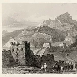
> Cheshire
> Langley
> Europe
> United Kingdom
> England
> Cheshire
> Related Images
> Map Marketing
> Postcode Sector Maps
> WD - Watford
> Maps and Charts
> Related Images
MADE IN THE USA
Safe Shipping with 30 Day Money Back Guarantee
FREE PERSONALISATION*
We are proud to offer a range of customisation features including Personalised Captions, Color Filters and Picture Zoom Tools
SECURE PAYMENTS
We happily accept a wide range of payment options so you can pay for the things you need in the way that is most convenient for you
* Options may vary by product and licensing agreement. Zoomed Pictures can be adjusted in the Cart.