Home > Europe > United Kingdom > England > Devon > Cross Green
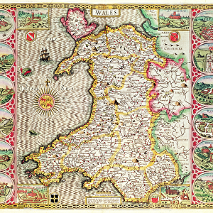
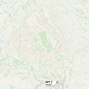
Monmouthshire NP4 7 Map

![]()
Wall Art and Photo Gifts from Map Marketing
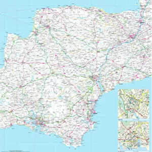
Monmouthshire NP4 7 Map
Postcode Sector Map of Monmouthshire NP4 7
Media ID 19977428
Acorn Close Albert Road Ambleside Bailey Street Bakery Close Bell Lane Broad Street Brynteg Chapel Close Church Road Commercial Road Cross Street Devon Place Earl Close Earl Street Emlyn Road Eridge Road Factory Lane Fairfield Close Farm Road Foundry Road Gordon Road Green Way High Street Hillcrest Lewis Close Lewis Street Lodge Road Manor Road Manor Way Monmouthshire Neville Street New Road North Road Oaks Road Old Lane Old Road Pentwyn Road Penylan Road Picton Road Prospect Place Raglan Close Railway Close Stanley Road The Avenue The Promenade Top Road Union Street Viaduct Road Waterloo Waterloo Place Waterloo Road Wellington Road Woodland View
FEATURES IN THESE COLLECTIONS
> Arts
> Artists
> P
> Francis Place
> Europe
> United Kingdom
> England
> Devon
> Church Green
> Europe
> United Kingdom
> England
> Devon
> Cross Green
> Europe
> United Kingdom
> England
> Devon
> Exeter
> Europe
> United Kingdom
> England
> Devon
> Related Images
> Europe
> United Kingdom
> England
> Devon
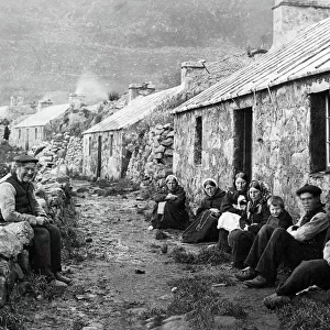
> Woodland
> Europe
> United Kingdom
> Wales
> Mid Glamorgan
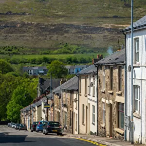
> Porth
> Europe
> United Kingdom
> Wales
> Monmouthshire
> Related Images
> Map Marketing
> Postcode Sector Maps
> NP - Newport
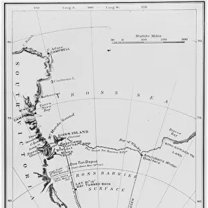
> Maps and Charts
> Related Images
> Popular Themes
> Devon
MADE IN THE USA
Safe Shipping with 30 Day Money Back Guarantee
FREE PERSONALISATION*
We are proud to offer a range of customisation features including Personalised Captions, Color Filters and Picture Zoom Tools
SECURE PAYMENTS
We happily accept a wide range of payment options so you can pay for the things you need in the way that is most convenient for you
* Options may vary by product and licensing agreement. Zoomed Pictures can be adjusted in the Cart.