Home > Europe > United Kingdom > England > County Durham > Durham
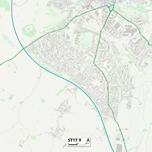
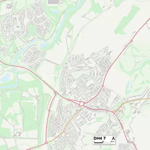
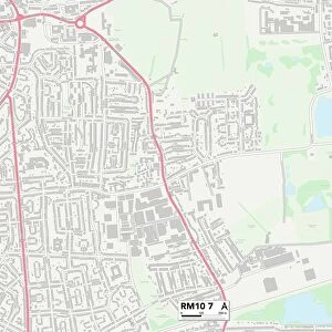
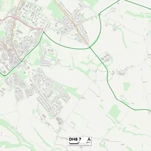
County Durham DH8 7 Map

![]()
Wall Art and Photo Gifts from Map Marketing
County Durham DH8 7 Map
Postcode Sector Map of County Durham DH8 7
Media ID 19968392
Alder Grove Back Lane Beech Road Birch Grove Bluebell Close Boyd Street Broadway Chapel Drive College View County Durham Durham Road Fairfield Forster Street Gill Street Gloucester Road Green Street Greenways Harwood Close Horton Close Ladywell Road Langdon Close Laurel Drive Lilac Place Main Street Meadow View Middleton Close Millfield Nelson Street Old Hall Road Percy Gardens Plantation Street Rotary Way St Ives Road Sunderland Street Sunningdale The Haven Valley View West Street Whitehall Lane Willow Crescent Woodside Drive Delves Glenmore Rolling Mill Sydney Gardens
FEATURES IN THESE COLLECTIONS
> Europe
> United Kingdom
> England
> County Durham
> Durham
> Europe
> United Kingdom
> England
> Durham
> Cotherstone
> Europe
> United Kingdom
> England
> Durham
> Delves
> Europe
> United Kingdom
> England
> Durham
> Durham
> Europe
> United Kingdom
> England
> Durham
> Eggleston
> Europe
> United Kingdom
> England
> Durham
> Holwick
> Europe
> United Kingdom
> England
> Durham
> Iveston
> Europe
> United Kingdom
> England
> Durham
> Knitsley
> Europe
> United Kingdom
> England
> Durham
> Mickleton
> Europe
> United Kingdom
> England
> Durham
> Romaldkirk
> Map Marketing
> Postcode Sector Maps
> DH - Durham
MADE IN THE USA
Safe Shipping with 30 Day Money Back Guarantee
FREE PERSONALISATION*
We are proud to offer a range of customisation features including Personalised Captions, Color Filters and Picture Zoom Tools
SECURE PAYMENTS
We happily accept a wide range of payment options so you can pay for the things you need in the way that is most convenient for you
* Options may vary by product and licensing agreement. Zoomed Pictures can be adjusted in the Cart.