Fraud Blocker Skip to main content

Home > Europe > France > Maps

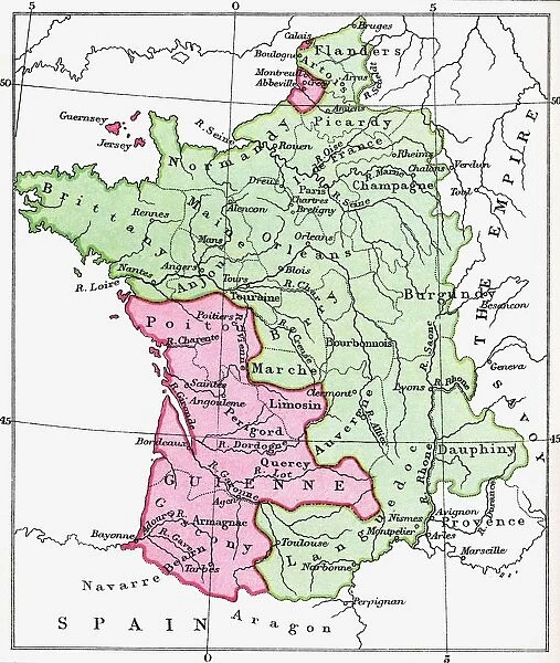
Map Of France At The Time Of The Treaty Of Bretigny, 1360. From The Book Short History Of The English People By J. R. Green, Published London 1893

Map Of France At The Time Of The Treaty Of Bretigny, 1360. From The Book Short History Of The English People By J. R. Green, Published London 1893


Photo Prints
Jigsaw Puzzles
Poster Prints
Canvas Prints
Fine Art Prints
Metal Prints
Home Decor


We accept all major credit cards

Design Pics

Wall Art and Photo Gifts from Design Pics

Map Of France At The Time Of The Treaty Of Bretigny, 1360. From The Book Short History Of The English People By J. R. Green, Published London 1893

Map Of France At The Time Of The Treaty Of Bretigny, 1360. From The Book Short History Of The English People By J.R. Green, Published London 1893

Design Pics offers Distinctively Different Imagery representing over 1,500 contributors

Media ID 18192159

© Ken Welsh / Design Pics

Ages Calais France Hundred Mediaeval Medieval Middle Middle Ages Treaty Years


FEATURES IN THESE COLLECTIONS

> Arts > Art Movements > Medieval Art

> Design Pics > Historical

> Design Pics > Vintage Maps

> Europe > France > Maps

> Europe > France > Military

> Maps and Charts > France

> Maps and Charts > Related Images


EDITORS COMMENTS
This print showcases a historical treasure - the Map of France at the time of the Treaty of Bretigny in 1360. Taken from J. R. Green's renowned book, "Short History of the English People" published in London back in 1893, this map offers a fascinating glimpse into medieval Europe. The intricate details and craftsmanship depicted on this mediaeval map transport us to a bygone era. It highlights significant locations such as Bretigny, Calais, and various regions within France during that period. The Treaty of Bretigny itself was a pivotal moment in history as it marked an important agreement between England and France after years of conflict. As we gaze upon this piece, we are reminded of the turbulent times during the Hundred Years' War - an intense struggle for power and territorial dominance between these two great nations. This map serves as a visual representation not only of geographical boundaries but also political alliances and conquests that shaped Europe during the Middle Ages. Ken Welsh's expert photography captures every nuance with precision, allowing us to appreciate both its historical significance and aesthetic beauty. Whether you are an avid historian or simply intrigued by medieval times, this remarkable print is sure to ignite your imagination and transport you back to one of the most intriguing periods in human history.

MADE IN THE USA
Safe Shipping with 30 Day Money Back Guarantee

FREE PERSONALISATION*
We are proud to offer a range of customisation features including Personalised Captions, Color Filters and Picture Zoom Tools

SECURE PAYMENTS
We happily accept a wide range of payment options so you can pay for the things you need in the way that is most convenient for you

* Options may vary by product and licensing agreement. Zoomed Pictures can be adjusted in the Cart.



redeem
Beautiful Photo Prints and Gifts
image
Professionally Printed
inventory
Photo Prints are in stock
thumb_up
Professional quality finish
diamond
Made with high-grade materials
inventory_2
Carefully packed to aid safe arrival


Related Images


A statue of Zoya Kosmodemyanskaya, brave woman partisan fighter during WWII
Johnston Crocodile - big Freshwater Crocodiles lying in wait in a river - Windjana Gorge National Park, Kimberley Region, Western Australia, Australia
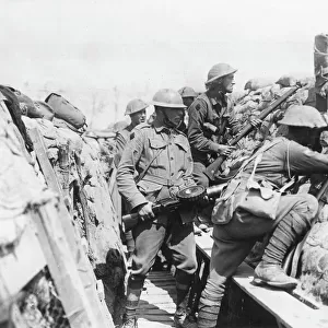
Australian troops in trench, near Armentieres, France, WW1
Tennessee Centennial Exposition, Nashville, Tennessee, 1897
Galileos diagram of the Copernican (heliocentric)
Barclay Vesey Art Deco Building
Patient positioned in computed tomography scanner
Lady Janes Orphanage, Baldovan, Dundee, Forfar
Babbages difference machine, 1864. Artist: Charles Babbage
Ruins of Bethune, France, World War I, c1915-c1918. Artist: Realistic Travels Publishers
Arctic grey wolf {Canis lupus arctos} running through snow, USA. captive
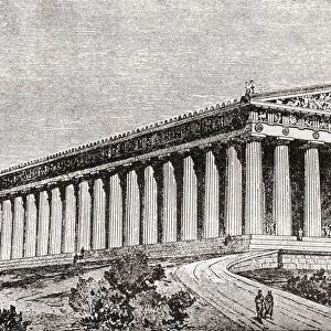
Exterior Of The Parthenon At Athens, Greece As It Would Have Appeared In Ancient Times. From The Book Harmsworth History Of The World Published 1908

+

Shipping

+

Choices

+

Reviews

+

Guaranteed


Related Collections


Vintage Maps
Vintage Maps
Browse 400 Prints
Maps
Maps
Browse 12,227 Prints
Medieval Art
Medieval Art
Browse 23,458 Prints
Maps and Charts Related Images
Browse 44,395 Prints
France
France
Browse 12,228 Prints
Military
Military
Browse 44,144 Prints
Historical
Historical
Browse 13,799 Prints